By late summer 2026, the pattern is no longer a series of isolated disasters – it is a single, interlocking system. A second heat dome in three weeks over the American West. A French wildfire season already declared the country’s worst on record. A Spanish blaze officials are calling the most destructive in the nation’s history. And, tying much of it together, a rapidly intensifying El Niño that the World Meteorological Organization now expects to become a strong event by autumn. What connects Phoenix to Bordeaux to the flood-prone valleys of the Hindu Kush Himalaya is not coincidence – it is a shared set of atmospheric and oceanic conditions now amplifying each other in real time.
America’s biweekly heat cycle
The western United States is now on its second major heat dome in roughly three weeks, following a ridge that stalled over the eastern half of the country in late June and was linked to at least 44 deaths while driving cities from Newark to Boston past the 100-degree mark and pushing the PJM Interconnection, which serves 65 million people, close to capacity. The western event has since brought triple-digit readings from Arizona to Montana, with Palm Springs approaching 120°F and roughly 55 million people under heat alerts across California, Nevada, and Arizona. In Las Vegas, meteorologists note the city’s August record stands at 116°F, with the all-time high – 120°F, set in July 2024 – also marking the hottest summer on record there.
The fire risk compounding that heat is severe enough that the National Weather Service issued a rare “Particularly Dangerous Situation” Red Flag Warning across central and eastern Washington, a designation reserved for the most extreme fire weather. Washington Governor Bob Ferguson declared a state of emergency and imposed a burn ban through September after a fast-moving fire near Spokane forced evacuations. As the state’s Department of Natural Resources put it, the combination of high winds and drought conditions could accelerate the spread of both existing and new fires, leaving already-stretched firefighters facing more dangerous conditions. Climate scientists interviewed by CNN describe the broader pattern — repeated, slow-moving heat domes affecting both the U.S. and Europe in the same season — as a signature of a warming climate system, even as researchers caution that the precise mechanics of why such domes may be growing more persistent remain an active area of study.
Europe’s tinderbox summer
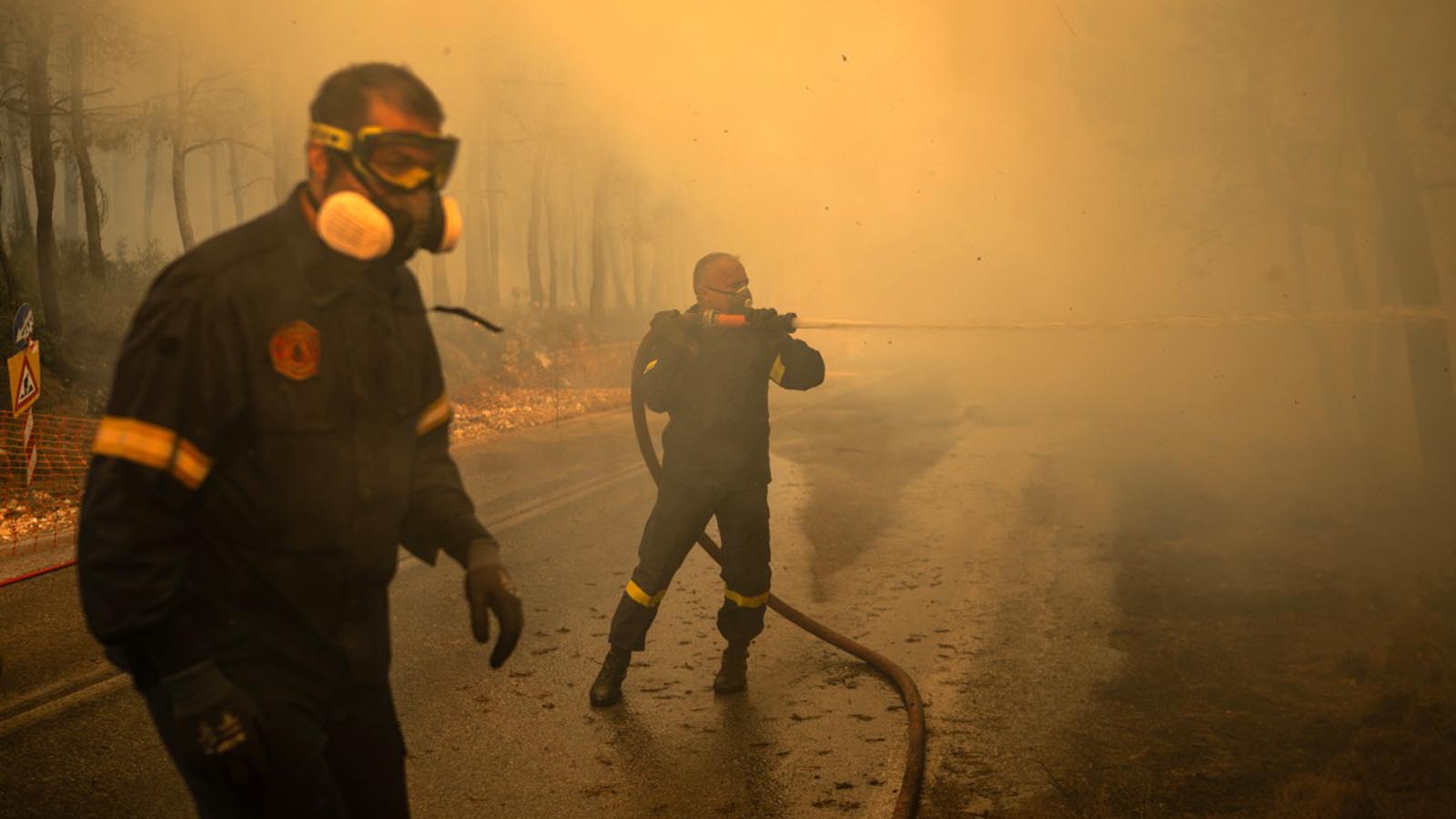
France has recorded an unprecedented number of individual fire outbreaks this season – more than 13,500 since it began, according to French interior ministry figures – with its largest single blaze, in Gironde near Bordeaux, having burned roughly 40,000 hectares. In Spain, the Ávila fire has been described by Interior Minister Fernando Grande-Marlaska as the largest and most destructive fire in Spain’s history, while a separate blaze in Burgohondo has scorched more than 50,000 hectares – the biggest ever recorded in the country – and the Madrid region alone has seen roughly 28,000 hectares burned and over 55,000 people evacuated or confined indoors.
Spanish Prime Minister Pedro Sánchez has rejected the framing of these fires as disconnected incidents, calling them instead the most painful expression of a climate emergency. Analysis from World Weather Attribution ties the severity directly to a compounding sequence: an unusually wet January that fueled heavy vegetation growth, followed by a summer of record heat that dried that same vegetation into ready fuel — the same feedback loop of heat-dome pressure and rapid evaporation described in early-season forecasts, now playing out on the ground. Spain’s national meteorological agency, AEMET, confirms this is on pace to be the country’s hottest summer on record. The pyrocumulonimbus clouds generated by fires of this intensity — fire-driven thunderstorms capable of sparking new blazes with their own lightning — represent a self-perpetuating hazard that firefighting agencies on both sides of the Pyrenees are now treating as a standing seasonal risk rather than a rare anomaly.
El Niño as the multiplier
Underlying both continents’ extremes is an oceanic driver the WMO has been tracking since spring. As Secretary-General Celeste Saulo confirmed in June, El Niño conditions are developing in the tropical Pacific and are expected to shape global weather through the rest of the year. The organization’s most recent seasonal update goes further, projecting the event will intensify into a strong El Niño between August and October, with sea-surface temperature anomalies in key monitoring regions expected to exceed 2.9°C – alongside a positive Indian Ocean Dipole, a separate warming pattern in the western Indian Ocean that tends to compound El Niño’s effects on rainfall distribution across South and Southeast Asia.
Historically, El Niño years correlate with elevated global mean temperatures and disrupted storm tracks, which helps explain why 2026’s heat and fire seasons in the Northern Hemisphere are arriving in tandem with anomalies half a world away in the Pacific and Indian Oceans. It is the same mechanism the WMO has flagged since April, when forecasters first noted the transition out of the 2025–26 La Niña into what has become one of the more confidently forecast El Niño developments in recent years.
South Asia’s paradox: A Monsoon that dries and drowns at once
The clearest illustration of how a single global driver can produce contradictory regional outcomes is unfolding in South Asia. The WMO’s own regional forum, held in the Maldives this spring, forecast a below-average monsoon for the 2026 season as El Niño conditions strengthen – a pattern that would ordinarily suggest reduced flood risk. But researchers at the International Centre for Integrated Mountain Development (ICIMOD) are warning that seasonal averages conceal a far more dangerous local reality. As disaster risk reduction specialist Saswata Sanyal explains, El Niño-driven dry spells can be punctuated by intense, short-lived storms – meaning long dry spells can be interrupted by intense local storms that trigger devastating flash floods and landslides, even in a below-average season. That contradiction has already materialized in cloudburst-driven flooding in Pakistan’s Gilgit-Baltistan and sudden, intense rainfall in India’s Arunachal Pradesh.
The underlying physical mechanism has a documented history: peer-reviewed research on Bangladesh and northeast India has found that warming Bay of Bengal sea-surface temperatures intensify the low-level jet that funnels moisture inland, quadrupling the frequency of the most extreme single-day rainfall events in the region since 1950. In a monsoon system already primed by a positive Indian Ocean Dipole, that mechanism gives this year’s “drier than average” forecast an unusually sharp edge – the aggregate numbers may look calmer even as the tail-risk events grow more violent.
The structural question behind the weather
What ties the American heat cycle, the Iberian fire season, and the South Asian monsoon paradox together is not just a shared meteorological driver but a shared stress test: whether infrastructure built for the climate of a generation ago – power grids, firefighting capacity, early-warning systems, urban drainage – can absorb events that are arriving in tighter succession and with less predictable seasonal cover. The near-capacity strain on the PJM grid in July, Washington’s unprecedented fire-weather warning, and ICIMOD’s warning that a “quiet” monsoon average can still mask lethal local extremes all point to the same underlying gap: seasonal forecasting and infrastructure planning are still built around averages, in a climate system that is increasingly defined by its extremes.